Community Information Request - Flood Studies
Published on 14 May 2026
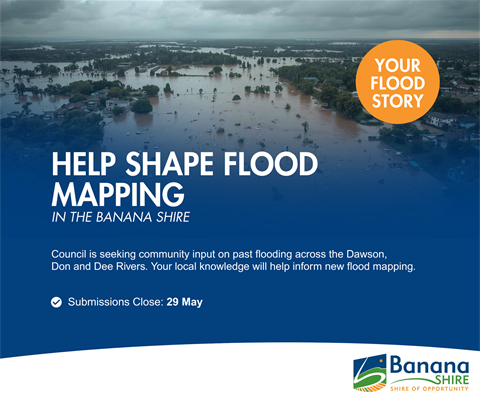
Banana Shire Council is undertaking a series of flood studies across the Dawson River basin, including communities along the Dawson River, Dee River, Don River, Kroombit Creek and associated tributaries. These studies will improve Council’s understanding of flood behaviour and help guide future planning, infrastructure design, and disaster preparedness across the region.
This work forms part of the Flood Risk Management Program (FRMP), jointly funded by the Australian and Queensland Governments under the Disaster Recovery Funding Arrangements (DRFA). The $34.25 million flood study and intelligence systems package is a key component of the broader $49 million program established following the 2021–22 rainfall and flooding events.
Understanding Flooding in Banana Shire
Flooding across the Shire is influenced by a range of factors, including:
- Widespread upstream rainfall across the Dawson catchment
- Riverine flooding with long travel times
- Breakout flows across broad floodplains
- Extended road closures and property isolation
The study will use rainfall records, river gauge data, topographic survey and hydraulic modelling to better understand:
- Flood levels and extents
- Flood depths and flow behaviour
- Impacts to homes, agricultural land and infrastructure
- Road overtopping and isolation risks
All work is being undertaken in line with contemporary Queensland floodplain management practices and guidance from the Queensland Reconstruction Authority.
Why Local Knowledge Matters
Local experience plays a critical role in ensuring flood models accurately reflect real-world conditions. Banana Shire has experienced several significant flood events, including:
- 2010-11 widespread flooding
- 2013 ex-Tropical Cyclone Oswald
- Recent 2026 flood events
Information from these events helps Council:
- Validate modelled flood levels
- Identify where rivers and creeks break out during floods
- Understand how long floodwaters remain
- Improve mapping of road closures and isolation
What Information is Council Looking For?
Council is seeking community input from past flood events, including:
Recorded Flood Levels
- Water depth at houses, sheds or fences
- River levels at bridges or crossings
- High-water marks
- Road inundation or overtopping
- Surveyed levels (if available)
- Date and time of peak flooding
- Location (address, map reference or clear description)
Property and Access Impacts
- Duration of isolation
- Access constraints
- Timing of peak flood levels
Historical Observations
- Changes to flow paths over time
- Areas affected by local rainfall versus river breakout
- Differences between flood events (level, timing, duration)
If possible, please include:
- Date of the flood event
- Exact location
- Your contact details (for follow-up if required)
How to Submit Information
Submit your information via to Council via the following mail address:
enquiries@banana.qld.gov.au
Subject: Dawson Flood Study Submission
Accepted formats: JPG, HEIC, PNG, PDF, DOCX, MP4
Privacy
All information provided will be used solely for the purposes of the flood study and associated reporting. Personal information will not be published without consent and will be managed in accordance with Council’s obligations under Queensland privacy legislation.
Key Dates
- Submissions open: 18 May 2026
- Submissions close: 29 May 2026
What Happens Next?
Following completion of modelling:
- A Draft Flood Study report will be prepared
- Flood mapping will be released to the community
- Further opportunities for feedback will be provided
Contact
Tel: (07) 4992 9500
Email: enquiries@banana.qld.gov.au