Banana Shire Flood Study - GOOVIGEN AND JAMBIN

Banana Shire Flood Study - GOOVIGEN AND JAMBIN
Historic flooding
Flooding at Goovigen is primarily governed by local flooding from Camp Creek. Flooding from Callide Creek has an impact on residents’ ability to access areas outside of the Township, particularly to Jambin. Jambin is impacted by flooding from the upstream Callide Creek and Kroombit Creek catchments. During significant events, flood levels are influenced by the existing railway embankment that traverses the floodplain at Jambin and the Burnett Highway embankment.
Extent of flooding
The below table explains the multiple Annual Exceedance Probability (AEP) flood events analysed as part of the Study. AEP indicates the probability of a flood event occurring each year expressed as a percentage. Flood probability can also be expressed as an Annual Recurrence Interval (ARI).
Annual Exceedance Probability, AEP |
Approximate Annual Recurrence Interval, ARI |
Impact on Townships |
|
10% chance of occurring each year or 10% AEP |
Approximately 1 in 10 year event |
|
|
5% chance of occurring each year or 5% AEP |
Approximately 1 in 20 year event |
|
|
2% chance of occurring each year or 2% AEP |
Approximately 1 in 50 year event |
|
|
1% chance of occurring each year or 1% AEP |
Approximately 1 in 100 year event |
|
|
1% AEP event Climate Change (CC) sensitivity simulation or 1% + CC AEP |
Approximately 1 in 100 year event - adjusted for climate change sensitivity |
|
|
0.05% chance of occurring each year or 0.05% AEP |
Approximately 1 in 2000 year event |
|
|
A Probable Maximum Flood (PMF) event is the largest flood event that could occur at any given location. It is usually an estimated rainfall depth calculated using a range of methods and patterns. |
|
|
Considering the information above, the proposed area of investigation to protect residents from the impact of flooding in Jambin is shown below. An existing levee on the western side of Goovigen already provides some flood protection for Goovigen from Camp Creek flooding. Therefore, additional direct structural measures are not being investigated in any areas within the Township. An inundation map for the 1% + CC AEP event is also shown below.
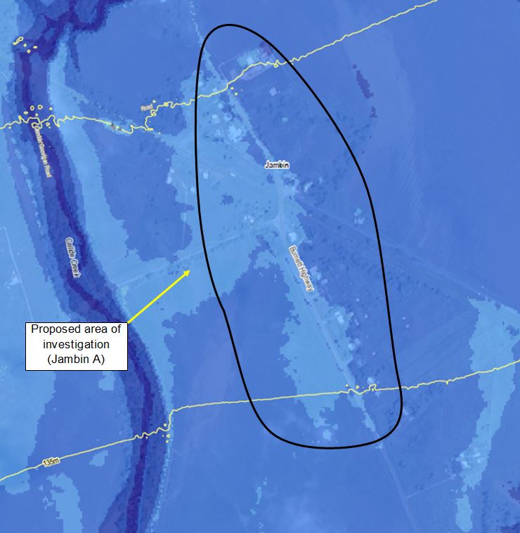
Image: Proposed area of investigation (Jambin) with 1% + CC AEP flood inundation depths shown
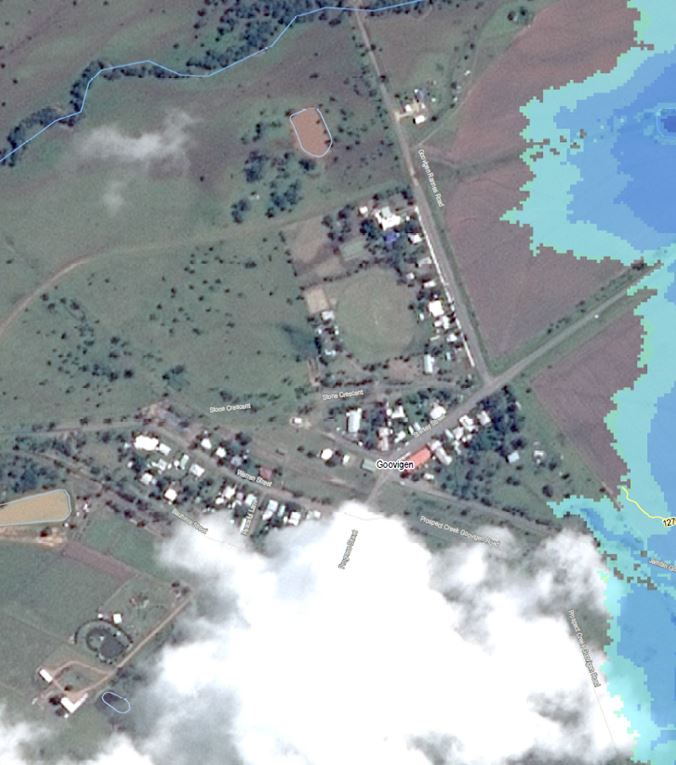
Image: 1% + CC AEP flood inundation depths (Goovigen)
Potential flood mitigation options
Flood mitigation strategies are aimed at reducing residual risk, improving safety, minimising damage by reducing peak flood levels and depths, improving warning times and reducing flow velocities. This can be achieved through both structural and non-structural measures.
Some non-structural measures already form part of Council’s current Local Disaster Management Plan and Planning Scheme. After the completion of the Floodplain Management Plan, additional measures and updates to Council’s plans and schemes may occur.
An existing levee on the western side of Goovigen already provides some flood protection for Goovigen from Camp Creek flooding. Therefore, additional direct structural measures are not being investigated in any areas within the Township. There are also limited opportunities to provide feasible structural measures to reduce the flood risk in Jambin due to the town’s position within the Callide Creek floodplain.
The structural measures identified that may reduce flood risk within the proposed area of investigation in Jambin include:
-
Low levees, large levees or a combination of both to provide some level of flood protection to residents
-
Individual property levees
-
Raising of existing stumped houses.
Submit your feedback
Community feedback is a vital tool when analysing the viability and acceptance of proposed areas of investigation. To submit your feedback, please fill out the survey by clicking on the link below.
When answering Question 4, please rate your most preferred option as 1, your second most preferred option as 2, your third option as 3, and least preferred option as 4.
Surveys can be downloaded and submitted by email at floodstudies@kbr.com or by mail at Reply Paid GPO BOX 633, Brisbane QLD 4001.
Survey for Goovigen and Jambin